
Trails Illustrated maps feature in-depth trail and mileage information, topographic terrain, public land boundaries, OHV approved areas, and campsites.
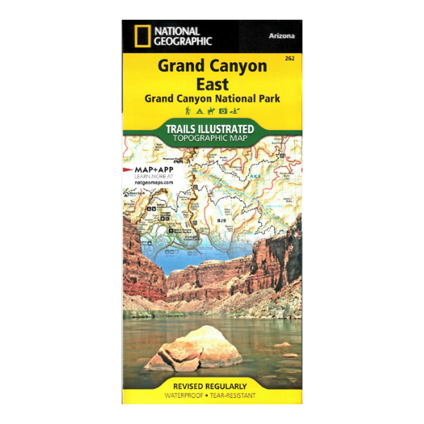
A large-scale map covering the entire eastern half of Grand Canyon National Park. This version completely overlaps the more detailed Grand Canyon North and South Rim map in the same series, and large portions of the Paria Canyon, Kanab map, covering all of Vermilion Cliffs National Monument. Not the best choice for backcountry exploration, but is a great guide to the more accessible portions of the park.
Obverse covers northeastern edges of Grand Canyon National Park, including the Vermilion Cliffs National Monument, and the Paria Canyon-Vermilion Cliffs Wilderness. Coverage extends to the edge of the Grand Canyon National Park at Glen Canyon National Recreation Area at the confluence of the Paria and Colorado Rivers.
Reverse features the vast majority of the National Park to the south, extending from the Deer Creek campgrounds and Havasupai Reservation in the west to Tatahatso Point and the confluence with the Little Colorado River to the east.
1:90,000 scale (1 inch=1.4 miles) with 100 ft. contour interval. Revised 2019, printed on water/tear-proof synthetic material. $14.95
Every purchase made through our online store helps us continue our nonprofit education programs and services on Southwest public lands.